The History of Ranchos de Taos
A Summary
By F.R. Bob Romero
Historic Background

The physical boundary of El Valle Water and Sanitation District, loosely known as Ranchos de Taos, NM is a historical community that has existed for more than 300 years. The area located in the southern end of the Taos Valley includes the communities or neighborhoods of Los Cordovas, Ranchos, Talpa, Llano Quemado, and Cordillera.
The unincorporated land has plazas, buildings, structures, rivers, acequias, and landmarks that clearly identify it as a Traditional Historic Community. The area has one post office and zip code and a distinct character and traditional culture that sets it apart from the surrounding region. The area should be designated as a Traditional Historic Community in accordance with the legislation passed in 2019 by the New Mexico Legislature
The Ranchos de Taos area has a longer history and had a greater population than the Town of Taos until the late 1800s. After the Revolt of 1680 when the Spaniards were forced to retreat from New Mexico, and the DeVargas “Reconquest” in 1692, when the Spaniards returned, the area of Ranchos de Taos was the first location to be resettled in the Taos Valley.
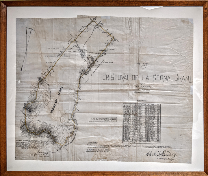
The Cristobal de la Serna Land Grant was first ceded in 1710 as the first act signifying the re-establishment of Spanish civil authority. The land was not occupied by Serna in 1710 so it was re-ceded in 1715 when Serna resigned his position as captain of the presidio in Santa Fe.
The Serna Land Grant is located on the extreme southern end of the Taos Valley starting at a point where Cruz Alta Road is located, and extending southward to the top of Picuris Peak. The Serna Grant is bordered on the east by the Sangre de Cristo mountain range.
The Francisca Antonia de Gijosa Land Grant was ceded by the Spanish government later in the same year of 1715 to Francisca Antonia Gijosa who was a widow living in Santa Fe at the time. The Gijosa Land Grant boundaries extend from Camino del Medio which is the western boundary of the Serna Land Grant to the Rio Pueblo and Los Cordovas.
The New Mexico National Guard Armory, the UNM-Taos Klauer Campus, The Taos Country Club and golf course, the Taos Water Treatment Plant are all located within the Gijosa Land Grant. The area of these two land grants roughly parallels the boundaries of El Valle de Los Ranchos Water and Sanitation District
Rivers - Acequias - Communities
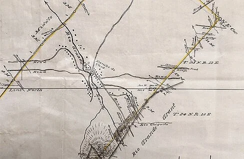
The center of settlement in the Cristoval de la Serna Grant is along the course of the Rio Chiquito and Rio Grande del Rancho, today as it was in 1894 when this map was created.

Talpa Reservoir / Deposito provides water storage for the Acequia Madre del Rio Chiquito and Acequia del Monte.
Courtesy Hank Saxe
The area has two major rivers, Rio Chiquito and Rio Grande del Rancho, that provide water for irrigation through the various acequias that includes Acequia Madre del Rio Chiquito, Acequia Abajo la Loma, Acequia en Medio, Acequia Jarosa, Acequia del Finado Francisco Martinez, and Acequia de Los Cordovas.
There are also three Mutual Domestic Water Consumer Associations, Talpa, Ranchos, and Llano Quemado, within the boundaries of El Valle de Los Ranchos Water and Sanitation District that were started in the 1950s.
Three main historic roads run from east to west connecting the entire area. These roads are Cuchilla, Highway 240 which runs through Cordillera to Los Cordovas, and Camino Abajo de la Loma.
Settlement of Ranchos Valley
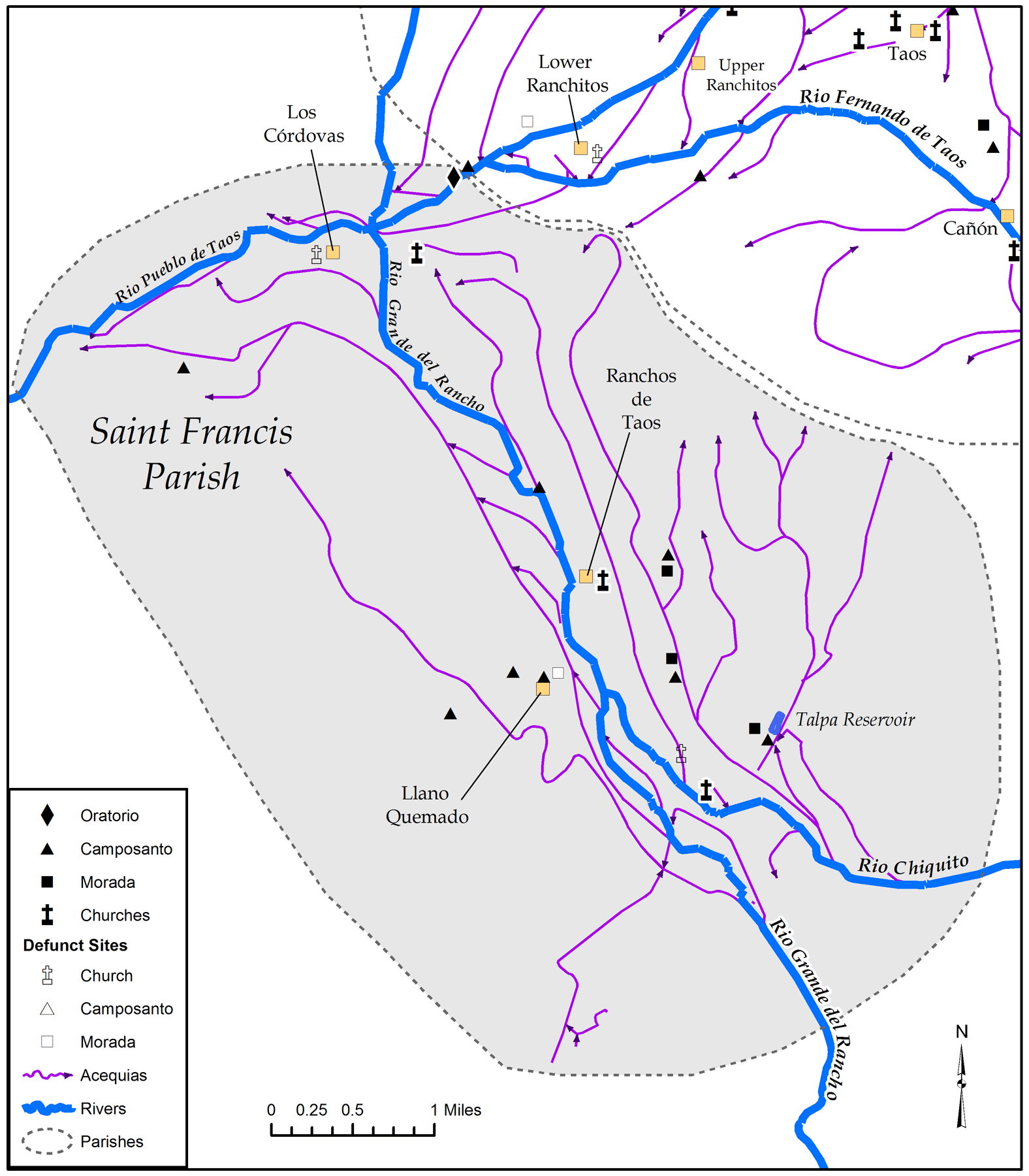
The historic setting of the communities in the Ranchos Valley. River, acequias and religious structures within the Parish of St. Francis.
Courtesy of Dr. Sylvia Rodriguez
Cristobal de la Serna was killed during the Villasur Expedition in 1720 and in 1724 ownership of the Serna Grant was transferred to Don Diego Romero. The Romero family lived on the land grant for several decades and by the 1760s there was a community in Ranchos de Taos made up of the Romeros, several other Spanish families, some Taos Pueblo Indians, a band of Jicarilla Apache, and some Genizaros who were detribalized Plains Indians.
The Comanche raids of the 1760s and 1770s led to the temporary re-location of these families to the Taos Pueblo for security. The families continued to tend to their farms and the Ranchos Plaza was constructed in the 1770s for protection against the nomadic Indian raids into the Taos Valley.
The Ranchos Plaza was completed and completely walled by 1779 and is listed on the National Register of Historic Places.
Historic landmarks
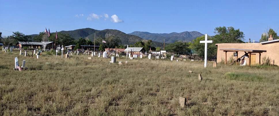
Rio Chiquito / Talpa Morada & Camposanto
Courtesy Hank Saxe
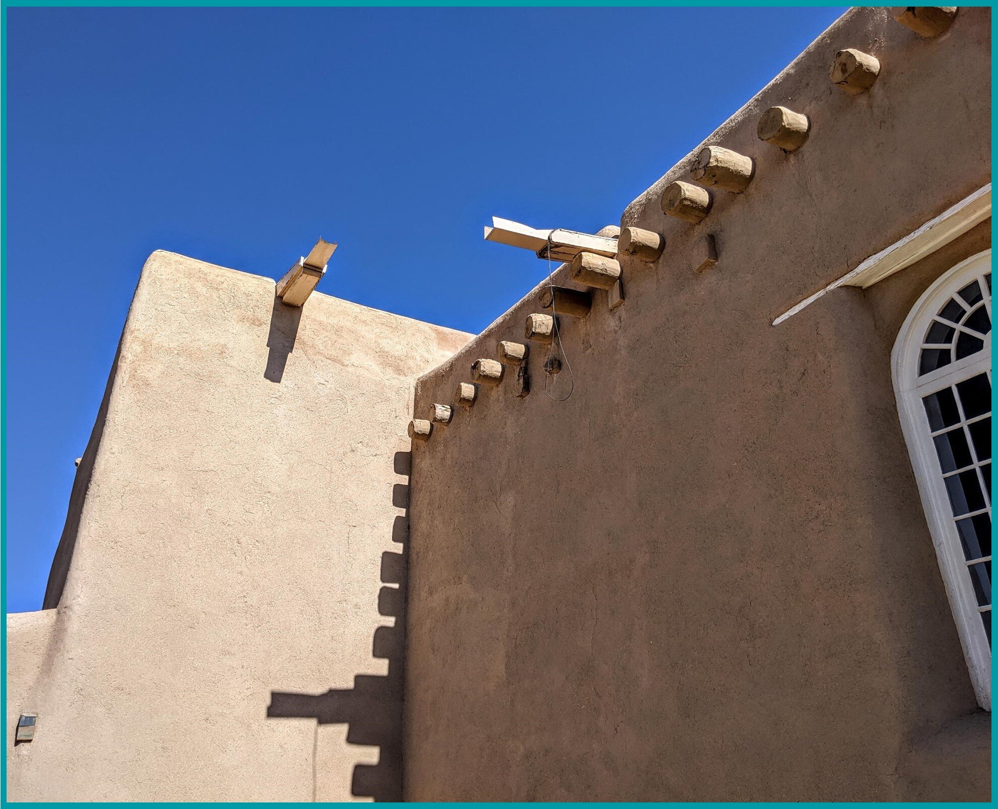
San Francisco de Asis Church, Ranchos de Taos.
Courtesy Hank Saxe
St. Francis of Assisi was accepted as the Patron of Ranchos, then known as Las Trampas, since the decade of the 1750s. The San Francisco de Asis Catholic Church was conceptualized at that time and was constructed and completed in 1815. The beginning of construction is unknown although the license to build the church was received in 1813.
The church is considered a National Historic Landmark, and today the San Francisco de Assisi Parish includes other religious structures such as the St. Francis School buildings, the Nuestra Senora de San Juan de los Lagos Capilla at Talpa, the Nuestra Senora del Carmen Capilla in Llano Quemado, and Los Cordova Capilla. The Presbyterian Church on the corner of San Francisco Road and State Road 68 dates to the late 1800s in the Territorial Period.
The Vigil Torreon in Talpa is another cultural resource located close to Highway 518. The Vigil Torreon dates to the 1700s and was active at the height of the raiding period from 1760 to 1780. It was built for defensive purposes as a lookout tower.
The Vigil Torreon was recently renovated and preserved by the Taos County Historical Society Preservation Committee. There are also three active Penitente Moradas that date to the 1800s in Talpa and the Ranchos area known as the Talpa Morada, San Francisco de Asis Morada on Highway 518, and Nazareno Morada on Espinoza Road.
Community cemeteries surround these moradas, and in addition other cemeteries in the valley include the Old and New Llano Quemado cemeteries and the Los Cordovas Cemetery.
Protect the Ranchos Valley as a Living Community

Parciantes-Acequia Madre del Rio Grande, Valerio Road-1958.
Courtesy Mildred Tolbert Family
The many longtime historic Ranchos de Taos families are closely related, intermarried, and intertwined. They are bound by the extended family connections, their religion, and their land and water associations and resources. The Ranchos area is contiguous and connected by history, culture, traditions, and the rich social fabric.
The area meets all the criteria of a Traditional Historic Community that should be preserved, protected, and so designated as a Traditional Historic Community.